Posts

Barpeta District

Image
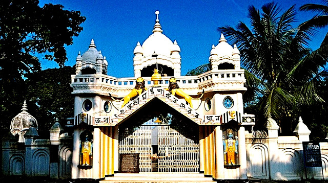
Barpeta District is a district in the state of Assam with its administrative headquarters in Barpeta city. Barpeta is an important religious place known by the names of Tatikuchi, Porbhita, Mathura, Vrindavan, Chaukhutisthan, Nabaratna-Sabha and many others.  When the great saint Shriman Shankardev came to Barpeta, he started many sessions or religious places in this area and because of these sessions, this place became a religious place. Because of this, Barpeta city is also called 'Boikunthpuri Dham' Before British rule, Barpeta place was an important part of Koch-Hajo and Ahom Empire. Barpeta region was ruled by different rulers like Varman, Salsthamus, Palas, Kamata and Koches during different periods. Area of Barpeta District The geographical area of the district is 2,282 sq km. And it is surrounded by the hills of Bhutan in the north, Kamrup district and Goalpara district in the south, Nalbari district in the east and Bongaigaon district in the west. The district consist

Bajali District

Image
Bajali district is a district in the Indian state of Assam, separated from Barpeta district. The Assam Cabinet, chaired by former Chief Minister Sarbananda Sonowal, approved the proposal to make Bajali a full-fledged district on August 10, 2020. On January 12, 2021, Bajali was formally declared a district. On 31 December 2022, the district was re-merged into the existing Barpeta district. However, on August 25, 2023, the Assam Cabinet announced the restoration of Bajali district; on October 12, Bajali became a district again. The district headquarters is located in the Pathshala town. Area of Bajali District The district covers an area of 418 km2 It is bounded by Baksa district on the north, Nalbari district on the east and Barpeta district on the west and south. Population in Bajali District As per the 2011 census, the population of the former Bajali district is 2,53,8 The sex ratio in Bajli is 978 females per 1000 males. Assamese, Bengali, Boro are the languages spoken here. Economy

Dima Hasao

Image
Dima Hasao district is a district in the Indian state of Assam. As of 2011, it was the least populous district of Assam. Dima Hasao district is one of the hill districts of Assam. Haflong, the district headquarters, is the only hill station in the state.  Haflong is a very famous tourist destination, which is also called Switzerland of the North-East. Earlier Dima Hasao was called North Cachar Hills District. The inhabitants of the present-day Dima Hasao district belonged to Mongolian groups who had begun to live in the mountainous areas and who held on to their culture, traditions and land rights from the beginning.  The present North Cachar Hills district was annexed to the old Cachar district with Asalu as its only police post. Then in 1880, this part was upgraded into a sub-division with its headquarters at Gunjang under Cachar district. Then, in the year 1895 the headquarters was shifted to Haflong area. Since that time, Haflong has continued to have the status of headquarters. 

Dibrugarh District

Image
Dibrugarh district is a district in the Indian state of Assam. The district headquarters is located in Dibrugarh city. Dibrugarh city is an industrial city with vast tea plantations in Upper Assam. It is located at a distance of 435 kilometers from the state capital Dispur. Dibrugarh district was a famous cantonment of Ahoms during the Ahom Sutia war and was earlier known as "Dibrumukh".  The name of the district is made up of two words "Dibru" and "Garh". The word "Dibru" has evolved from the Dibru River of Assam meaning "blister" and "Garh" meaning "fort". During the British rule, a fort was built on the banks of river "Dibru". Hence, the natives believe that this could be the reason behind the name "Dibrugarh".  In the year 1842, the British declared Dibrugarh as the headquarters of Lakhimpur district. During the period of World War II, the city of Dibrugarh was a major military base and was u

Dhubri District

Image
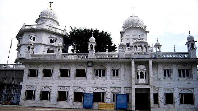
Dhubri district is a district in the state of Assam. The headquarters of the district is located at Dhubri town . The district is named after its headquarters town Dhubri. There are many interesting stories associated with the name of this place.  Dhubri Gurdwara According to one story, Netai Dhubuni used to wash her clothes on the surface of a big stone on the banks of the Brahmaputra river. Therefore, earlier this place was called “ Netai Dhubunir Ghat ” but with the passage of time the name of this place was changed to Dhubri. On the other hand, according to the Bodo-Kacharis, the origin of the word is derived from the Bodo word dubra which means a type of grass. Dhubri, is known as the gateway to Western Assam. Dhubri district came into existence on July 1, 1983. Things to in Dhubri District Dhubri district is full of attractive natural beauty. Both the banks of the Brahmaputra River delight the eyes of the beholders with their lush green fields, blue hills and dunes. Gurudwara T

Dhemaji District

Image
Dhemaji district is an administrative district in the state of Assam in India. The district headquarters is located at Dhemaji town and the commercial headquarters of the district is located at Silapathar. There are many mythological and imaginary beliefs among the local people regarding the origin of the name "Dhemaji". One of the most prominent beliefs is that – once upon a time there was a river which frequently changed its course and as a result unpredictable floods covered different parts of the area. Thus, the river was considered a type of evil spirit in this region. The word 'Dhemaji' is derived from two Assamese words namely "Dhal" means flood and "Dhemali" means "to play". Both words together mean "a place where floods occur frequently". Dhemaji became a full-fledged district on 14 October 1989 when it was separated from Lakhimpur district. Dhemaji is located in the foothills of the lower Himalayas, it is a relatively